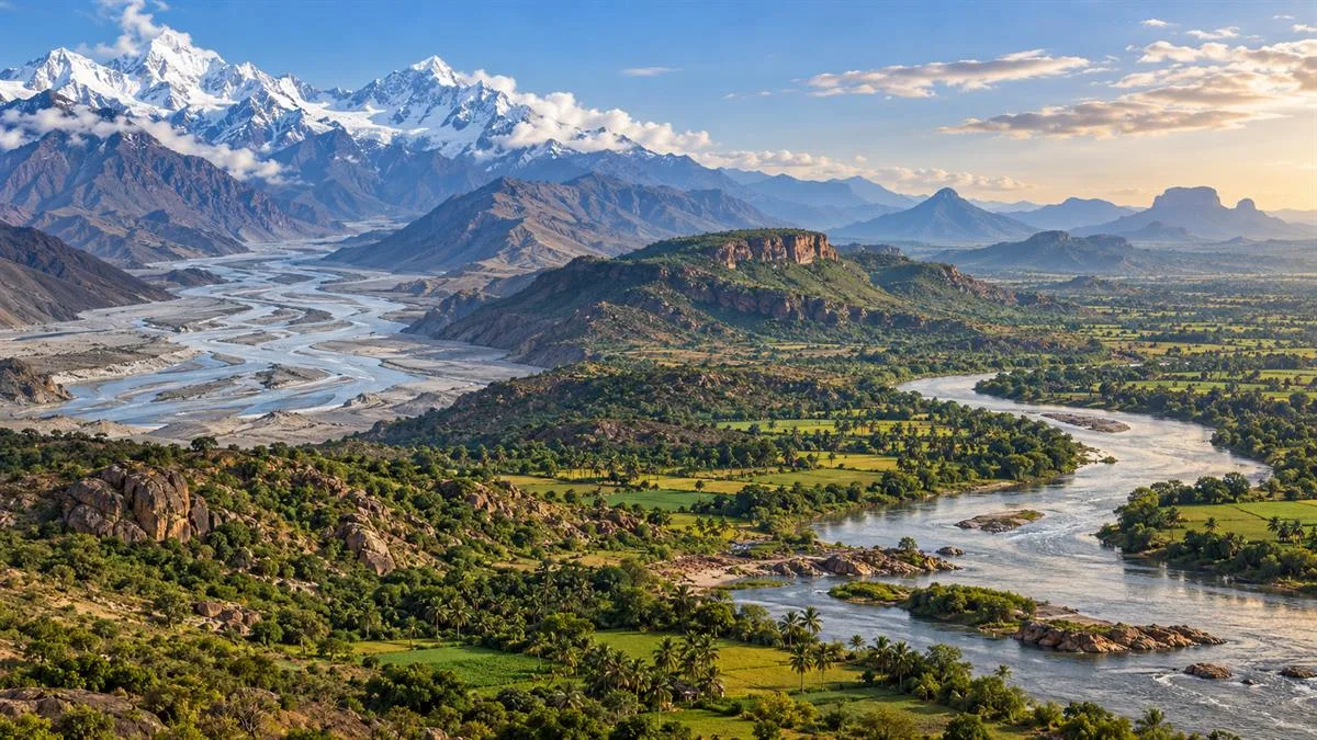
Why river systems matter in Indian geography
A river is more than a line on a map. Its basin connects rainfall, snowmelt, slopes, soils, settlements, agriculture, transport and ecosystems. India’s rivers cross mountains, plateaus, plains and coastal regions, so their courses provide clues about the structure and evolution of the land. For geography questions, candidates need to understand both the major named rivers and the physical processes that shape them.
A useful first division is between the Himalayan river systems and the Peninsular river systems. This is a broad geographical comparison, not a rule that every river in a group behaves identically. Relief, geology, climate, tributaries and human modification create local differences. Reading the map together with these controls is more effective than memorising isolated river names.
Drainage basin, watershed and drainage pattern
A drainage basin is the area from which a river and its tributaries collect water. Its boundary is usually a watershed or divide, often formed by higher ground. Water on opposite sides of a divide flows into different river systems. Basin boundaries rarely match state or district borders, which is why river management often needs coordination across administrative units.
Drainage pattern describes how channels are arranged in a landscape. A dendritic pattern resembles branching tree limbs and commonly develops where rock structure offers relatively uniform resistance. A trellis pattern, with tributaries joining a main stream at near-right angles, can develop where alternating bands of resistant and weaker rocks guide flow. Radial drainage spreads outward from a central highland, while rectangular patterns may reflect joints or faults. These names describe map patterns; they do not identify a river’s age or water volume by themselves.
The Himalayan river systems
The Indus, Ganga and Brahmaputra systems are the principal Himalayan river systems. Their basins extend across very large areas and include tributaries that descend from high mountain zones into the northern plains. Many Himalayan rivers receive water from both rainfall and melting snow or glaciers. This helps sustain flow beyond the rainy season, although discharge still varies with season, weather, snow conditions and human use. “Perennial” should not be taken to mean that flow is constant or that every small tributary carries water throughout the year.
The Indus system includes the Jhelum, Chenab, Ravi, Beas and Sutlej among its major tributaries. The Ganga system is fed by Himalayan tributaries such as the Yamuna, Ghaghara, Gandak and Kosi, as well as rivers from the Peninsular uplands. The Brahmaputra is known by different names along its course: it flows east across Tibet, enters the eastern Himalaya, and then traverses Assam before continuing into Bangladesh. Its large tributaries and braided channels make the basin an important case for studying floods and sediment movement.
As these rivers leave steep mountain valleys and enter the plains, the slope decreases. They may deposit sediment, form broad floodplains, develop meanders and shift channels over time. This creates fertile land and supports dense settlement, but it also creates flood risk. The same river can bring water and sediment that sustain agriculture while threatening people and infrastructure during high flows.
Peninsular rivers and plateau drainage
Peninsular rivers generally flow across an older and more stable plateau landscape than the young Himalayan mountain belt. Their courses are strongly influenced by the plateau’s slope, rock structure and the location of the Western and Eastern Ghats. Many are primarily rain-fed and show a stronger seasonal change in discharge, but reservoirs, groundwater interaction and local rainfall can alter that pattern. Their valleys, gradients and channel forms vary with the terrain they cross.
Most major Peninsular rivers flow eastward to the Bay of Bengal. The Godavari, Krishna, Mahanadi and Kaveri drain large parts of the plateau and form extensive river basins. As they approach the coast, some distribute sediment through deltaic channels. The Narmada and Tapi are major west-flowing exceptions; they follow rift-like valleys toward the Arabian Sea. Many short rivers flowing from the Western Ghats to the west coast are steep and comparatively short because the mountain range lies close to the sea.
These contrasts are useful, but they should not be made absolute. River flow reflects rainfall timing and amount, catchment storage, dams, diversions and groundwater. A plateau river may carry substantial flow during a wet season, while a Himalayan basin can experience low or irregular discharge in some reaches. Geography explains broad tendencies; local evidence explains the exceptions.
Himalayan and Peninsular systems compared
| Feature | Himalayan systems | Peninsular systems |
|---|---|---|
| Relief and setting | Mountain headwaters descend into extensive plains and valleys. | Courses cross plateau surfaces, escarpments and coastal plains. |
| Water sources | Rainfall plus snow and glacier melt in many upper catchments. | Rainfall is a major source; seasonal variation is often more pronounced. |
| Course and landforms | Long systems with mountain gorges, floodplains, meanders and shifting channels. | Courses are often more structurally guided; rivers cross hard rock, valleys and coastal plains. |
| General direction | Several major systems flow toward the Arabian Sea or Bay of Bengal through the plains. | Most major rivers flow east; Narmada and Tapi are prominent west-flowing exceptions. |
| Exam focus | Tributaries, basin regions, mountain exits, floodplains and cross-border continuities. | Water divides, east–west flow, deltas, estuaries and the influence of plateau relief. |
Why river courses and landforms differ
Relief controls the direction and speed of flow. A steep gradient increases a river’s energy and its ability to erode vertically; a gentler gradient encourages deposition and lateral movement. Rock type and geological structures matter too. Resistant rock can guide a channel into a narrow valley, while weaker material may be eroded more easily. Faults and fractures can influence valley direction, as seen in the broad structural setting of the Narmada and Tapi valleys.
Climate changes the quantity and timing of water. Monsoon rainfall can produce sharp increases in discharge; snowmelt contributes to many northern headwaters; drought reduces inflows. Sediment supply also varies. When a river loses energy, it deposits part of its load. In mountain-front and plain environments, this process helps build fans, floodplains and channels that may migrate. Near the coast, wave action and tidal conditions interact with river sediment to shape estuaries and deltas.
Human activity modifies these natural processes. Dams store water, change the timing of flow and trap sediment. Canals divert water for farms and cities. Embankments can protect one stretch while shifting pressure elsewhere. Urban surfaces increase rapid runoff, and sand extraction can alter channels. A sound Mains answer connects such interventions to the basin rather than treating a river only as a water source.
Map skills for Prelims and State PCS
On a blank map, practise locating the major basins and tracing river direction from source region to outlet. For the Indus, know the broad sequence of its major tributaries. For the Ganga, distinguish Himalayan tributaries from those entering from the Peninsular side. For the Brahmaputra, follow its east-to-west course across Assam and its continuation into Bangladesh. For plateau rivers, compare the east-flowing Godavari, Krishna, Mahanadi and Kaveri with the west-flowing Narmada and Tapi.
Do not memorise a confluence as a detached fact. Ask which basin it belongs to, which side of the main channel the tributary joins, what relief controls its direction and whether the system drains to a sea, delta or inland basin. State PCS candidates can add a relevant state example: the Kosi and Gandak in Bihar, the Chambal in Madhya Pradesh and Rajasthan, the Godavari in Maharashtra and Telangana, or the Kaveri across the southern plateau. Check the specific route and state context before using a detailed local example.
Common misconceptions
- “All Himalayan rivers have the same flow throughout the year.” Their water sources support flow, but discharge changes by season and reach.
- “All Peninsular rivers dry up in summer.” Many show stronger seasonality, but storage, rainfall and local conditions matter.
- “Every east-flowing river forms the same kind of delta.” Coastal conditions and sediment determine whether a delta, estuary or other form develops.
- “A river basin follows political boundaries.” Basins are defined by watersheds and often cross state borders.
- “River names alone explain drainage.” Relief, structure, climate and land use shape the network and its changes.
Using the topic in UPSC answers
For Prelims, revise river sources, tributaries, drainage directions, watershed concepts, drainage patterns and delta-versus-estuary distinctions. Use physical maps to build spatial memory and watch for statements that turn a broad tendency into an absolute rule.
For Mains, organise a response around the basin, its physical controls, regional pattern and human significance. A comparison question can use the table above; a flood or water-management question should discuss rainfall, catchment relief, sediment, land use and institutions together. In a State PCS answer, connect the national pattern with one local basin and its implications for irrigation, floods, transport or livelihoods. Avoid unsupported numerical comparisons if the question does not require them.
Revision takeaway
India’s drainage is a product of landform, structure and climate. Remember the three principal Himalayan systems, the general eastward flow of major Peninsular rivers and the Narmada–Tapi exception, then explain how local conditions modify those patterns.
Practicing UPSC Prelims PYQs?
Practice 45+ years of topic-wise previous year questions (1979–2026) with in-depth explanations on our mobile app.
Never miss a daily update
Join our official Telegram channel or WhatsApp group for daily current affairs and test alerts.
Frequently Asked Questions
Test yourself · 10 practice questions
Practice MCQs on Indian River Systems: Himalayan and Peninsular Rivers
Check how well you understood this article with 10 UPSC-style multiple-choice questions — instant answers with detailed explanations.
View all questions with answersTags
Related Articles
Mauryan Administration: Structure, Sources and Limits
Explore how the Mauryan Empire governed a large and diverse territory through a royal centre, provincial hubs, officials, revenue systems a…

NCERT Geography for UPSC: A Chapter-Wise Priority List from Class 6 to Class 12
Geography NCERTs run to seven books and about seventy chapters, and they are not equally important. This guide ranks every chapter into thr…

NCERT Polity and History for UPSC: What to Read, What to Skip and What to Extract
The Polity and History NCERTs together run to more than a dozen books, and the exam draws on a third of them. This guide goes book by book:…
Keep reading
More in UPSC CSE
- NCERT How to Prepare NCERTs for UPSC: Subject-Wise Booklist and Reading Method
- Optional & Subjects Colonial Land Revenue: Permanent, Ryotwari and Mahalwari
- Current Affairs Pumped Storage Hydropower: Energy, Efficiency and the Grid
- Optional & Subjects Constitutional Writs: Articles 32 and 226 Explained
- Current Affairs Khelo India Sports Goods Scheme: Manufacturing and MSMEs
- Current Affairs National Unity Day: Patel, Integration and India’s Union