Why the Indian monsoon matters
The Indian monsoon is more than a rainy season. It is a seasonal reversal of winds that redistributes heat and moisture across South Asia. Its rainfall supports agriculture, replenishes rivers and reservoirs, and affects livelihoods, transport and energy demand. Yet the same monsoon can bring floods in one region while another faces a long dry spell.
For UPSC and State PCS, study the monsoon as a connected system: the seasonal shift of pressure belts, cross-equatorial winds, two branches, relief, rain-bearing systems and breaks. This framework explains both the broad national pattern and local contrasts.
How does the southwest monsoon form?
In late spring and early summer, the Indian landmass heats rapidly. A broad low-pressure region develops over northwestern parts of the subcontinent, while pressure over the southern Indian Ocean is comparatively higher. At the same time, the Inter-Tropical Convergence Zone (ITCZ), a belt where trade winds meet and air rises, shifts northward with the apparent movement of the Sun.
Southeast trade winds from the Southern Hemisphere cross the Equator and are deflected by Earth’s rotation. After crossing, they blow broadly from the southwest toward the Indian subcontinent. This cross-equatorial flow becomes the southwest monsoon. Differential heating helps set up the pressure contrast, but it is not a complete explanation by itself: large-scale circulation, ocean-atmosphere conditions, upper-air winds and topography also shape the monsoon.
The seasonal reversal of winds is the defining idea. The monsoon is not simply a burst of rain or a wind that changes direction on one date. Its arrival, advance, active spells and withdrawal are parts of a larger circulation.
Onset: more than the first shower
The southwest monsoon normally sets in over Kerala around 1 June and advances northward, often in surges. These are climatological expectations, not a promise that every district will receive rain on a fixed date. The India Meteorological Department (IMD) declares onset over Kerala using a combination of rainfall, wind-field and satellite outgoing longwave radiation criteria. In brief, rainfall at a prescribed share of 14 stations must meet a threshold for two consecutive days after 10 May, while the circulation and cloudiness criteria must also concur.
This is why a pre-monsoon thunderstorm or an isolated heavy shower is not, by itself, proof that the monsoon has arrived. The onset declaration identifies an established, large-scale advance. The Northern Limit of Monsoon marks its furthest advance on a given day; the entire country is normally covered around mid-July.
The two branches of the southwest monsoon
After reaching the Indian region, the moisture-bearing flow is commonly described through two branches. They are parts of the same seasonal circulation, but their routes and relief barriers create different rainfall patterns.
Arabian Sea branch
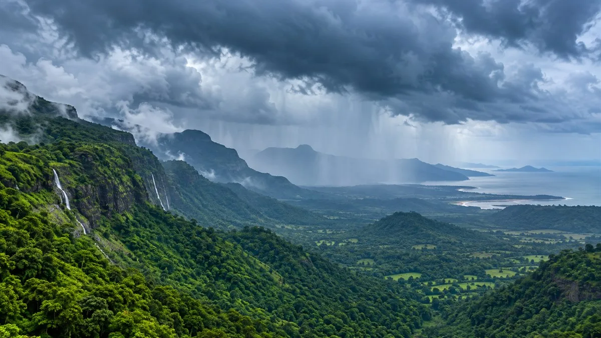
The Arabian Sea branch strikes the west coast. Moist air is forced to rise along the Western Ghats, producing heavy rain on the windward slopes. As air descends on the eastern, leeward side, it is drier, creating a rain-shadow pattern over parts of the Deccan Plateau. The branch also moves northward along western India and contributes to rainfall over central and northwestern regions as the circulation and rain-bearing systems evolve.
The contrast between the wet Konkan and Malabar coasts and drier interiors is a useful example of orographic rainfall. The mountains do not create moisture; they lift moisture-laden air and influence where it condenses.
Bay of Bengal branch
The Bay of Bengal branch moves toward northeast India and the Ganga plains. The hills of Meghalaya and the surrounding relief force moist air upward, contributing to very heavy rainfall in parts of the northeast. The flow then turns westward along the plains, where monsoon depressions and low-pressure systems can carry rainfall inland.
The branches interact with relief and pressure patterns rather than behaving as two isolated streams. Their effects also vary over time: a shift in the monsoon trough or the path of a low-pressure system can change which region receives the larger share of rain.
Why rainfall is uneven
India’s monsoon rainfall is uneven in both space and time. Relief is one reason: windward slopes tend to be wetter than leeward slopes. Distance from the sea matters too, because coastal areas receive maritime influence while interiors experience stronger continental conditions. The Himalayas help shape circulation and obstruct the northward movement of monsoon systems.
Rainfall also depends on the position of the monsoon trough, an elongated low-pressure zone that is a semi-permanent feature of the summer circulation. Low-pressure areas and depressions, often forming over the Bay of Bengal, can travel inland and distribute rain along their tracks. Their frequency, location and movement vary from season to season.
These controls explain why a countrywide seasonal total can hide local scarcity or excess. A normal national average does not mean that every district, crop season or river basin received normal rainfall. For answers, distinguish the all-India total from regional distribution and timing.
Active and break spells
The monsoon does not rain continuously at the same intensity. During active spells, rainfall is higher than normal across affected regions. During a break, widespread rainfall over the main monsoon-trough zone is interrupted for several days. These are phases of the seasonal circulation, not evidence that the monsoon has ended.
The trough’s position helps explain the pattern. When it shifts south of its usual position, rainfall can strengthen over large parts of the country. When it shifts north toward the Himalayan foothills, much of central India may receive less rain while the foothills and parts of the northeast receive heavy rainfall. A break therefore redistributes rainfall; it does not mean every part of India becomes dry at once.
This distinction is useful in both physical and human geography. The same shift can affect crop water availability, reservoir inflows and flood risk in different regions. Avoid describing every dry interval as a drought: drought is a more sustained condition assessed through rainfall and other relevant impacts.
Common misconceptions to avoid
- “The monsoon is just rainfall.” It is a seasonal circulation and wind reversal; rain is one of its major effects.
- “The first rain means onset.” IMD uses multiple criteria to identify established onset over Kerala.
- “Break means the monsoon has withdrawn.” A break is a temporary lull in widespread rain over the trough zone during the season.
- “A normal all-India total means normal rainfall everywhere.” The national average can conceal substantial regional and temporal differences.
- “One factor explains every monsoon outcome.” Heating, circulation, ocean-atmosphere conditions, rain-bearing systems and relief interact.
UPSC Prelims and Mains approach
For Prelims, revise the seasonal wind reversal, the northward shift of the ITCZ, the cross-equatorial flow, the Arabian Sea and Bay of Bengal branches, the Western Ghats rain shadow, and the definition of a break spell. Be precise about the onset declaration: rainfall, winds and satellite cloudiness are considered together.
For Mains, organize an answer around mechanism, spatial pattern and variability. A small labelled sketch can show the two branches, the Western Ghats, the Bay of Bengal and the monsoon trough; avoid drawing unsupported boundaries. Then explain one contrast, such as heavy windward rainfall versus a leeward rain shadow, and one temporal shift, such as active and break conditions. Conclude by linking reliable monsoon analysis to agriculture, water management and disaster preparedness without claiming that seasonal rainfall is uniform.
Conclusion
The Indian monsoon is best understood as a dynamic system. Seasonal heating and the northward-shifting ITCZ help establish the circulation; the two branches interact with relief; and the monsoon trough and low-pressure systems redistribute rain through active and break spells. Connecting these pieces makes the topic easier to recall and produces stronger geography answers.
Practicing UPSC Prelims PYQs?
Practice 45+ years of topic-wise previous year questions (1979–2026) with in-depth explanations on our mobile app.
Never miss a daily update
Join our official Telegram channel or WhatsApp group for daily current affairs and test alerts.
Frequently Asked Questions
Test yourself · 10 practice questions
Practice MCQs on Indian Monsoon Explained: Mechanism, Branches and Breaks
Check how well you understood this article with 10 UPSC-style multiple-choice questions — instant answers with detailed explanations.
View all questions with answersTags
Related Articles
Colonial Land Revenue: Permanent, Ryotwari and Mahalwari
What was permanent in the Permanent Settlement, and what did direct settlement with a ryot actually change? Compare colonial revenue system…

Constitutional Writs: Articles 32 and 226 Explained
Constitutional remedies depend on the right involved and the legal defect requiring correction. Understand how Articles 32 and 226 differ, …

Ocean Currents, Upwelling and Climate: A Conceptual Guide
Why can a sunny coast have cold water and rich fisheries? Understand how winds, rotation and density shape ocean circulation. This guide ex…
Keep reading
More in Optional & Subjects
- Optional & Subjects Fiscal, Revenue and Primary Deficits: Reading the Budget
- Optional & Subjects Ecosystem Energy Flow: Food Chains and Ecological Pyramids
- Optional & Subjects Harappan Cities: Planning, Water and Archaeological Evidence
- Optional & Subjects Plate Tectonics: Boundaries, Earthquakes and Mountains
- Optional & Subjects CRISPR-Cas9 Gene Editing: How It Works and Its Limits
- Optional & Subjects Inflation in India: CPI, WPI and GDP Deflator