Why do earthquakes, volcanoes and mountains form in belts?
A mountain range, a deep ocean trench and a line of earthquakes may look like unrelated features. Plate tectonics connects them through the movement of Earth's rigid outer shell. Instead of treating every landform as an isolated fact, ask what neighbouring plates are doing: separating, approaching or sliding past one another. That question provides a starting point for understanding the landscape and its geological activity.
The theory is especially useful for UPSC and State PCS because it links physical geography with natural hazards. It explains broad patterns, but it does not mean that every location on a boundary behaves identically. The type of material involved, the direction of movement and the history of deformation matter. Learn the model first, then use examples to understand its limits.
What exactly is a tectonic plate?
A tectonic plate is a piece of the lithosphere: the crust together with the rigid uppermost mantle. It is not simply a continent, nor is it made only of crust. A single plate can carry continental and oceanic areas. Coastlines separate land from sea; plate boundaries separate moving lithospheric units. These two kinds of boundary need not coincide.
Below the lithosphere lies the mechanically weaker asthenosphere. Avoid imagining that the entire mantle is a liquid ocean on which continents float. Mantle rock is predominantly solid, yet it can deform and flow over geological time. This distinction between material composition and mechanical behaviour explains why the crust–mantle division is not the same as the lithosphere–asthenosphere division.
Plate movement is slow on a human timescale, commonly measured in centimetres per year. Its cumulative effect over millions of years is large. A small annual displacement can therefore help produce a major ocean basin or mountain belt without requiring rapid movement every day. Slow background motion and sudden earthquake rupture describe different parts of the same tectonic setting.
Three basic boundary types
| Boundary | Relative movement | Useful first association |
|---|---|---|
| Divergent | Plates move apart | Spreading ridges and continental rifts |
| Convergent | Plates approach | Subduction or continental collision |
| Transform | Plates slide laterally past one another | Faulting and shallow earthquakes |
These categories describe relative movement, not whether a boundary lies on land or under water. Start with the movement before assigning a landform. Also remember that real boundaries may occupy broad zones rather than a perfectly thin line. A simple classroom model is a useful organising tool, not a substitute for detailed regional geology.
Divergence: how new ocean floor forms
At an oceanic spreading ridge, plates separate and mantle material rises. Magma supplies new oceanic crust, which moves away from the spreading centre as the process continues. The ridge is therefore associated with construction of ocean floor. It is an underwater mountain system, not an ocean trench. Confusing those features reverses the underlying movement.
Divergence also occurs within continents. Stretching and faulting can produce a rift system; the East African Rift is a familiar example. A continental rift should not automatically be described as an already completed ocean basin. Rifting describes an ongoing tectonic process, while an ocean basin describes a geographical result that depends on continued development.
For an examination question, look for a consistent sequence: separation, extension, rising material and creation of crust at an oceanic spreading centre. A choice that combines a ridge with the routine consumption of oceanic lithosphere is mixing divergent and subduction settings. The sequence is more reliable than recalling a single associated word.
Convergence: the material makes a difference
Oceanic lithosphere and subduction
Subduction occurs when one plate descends beneath another. Where oceanic lithosphere is involved, a trench and a volcanic arc can occur in the same regional system. They are related features but not identical locations. The trench marks the surface expression of the descending plate boundary; the volcanic arc develops on the overriding plate.
Fluids released from the descending slab can promote partial melting in the overlying mantle. Magma may rise and feed volcanoes. It is therefore misleading to explain all subduction volcanism simply as the entire descending plate melting from friction. The role of fluids and the location of melting are important distinctions.
Oceanic–continental convergence is associated with the Andes, while oceanic–oceanic subduction can produce an island arc. In each case, identify the descending and overriding sides before describing the resulting features. The presence of an island does not by itself establish its origin; the geological setting must support the interpretation.
Continental collision
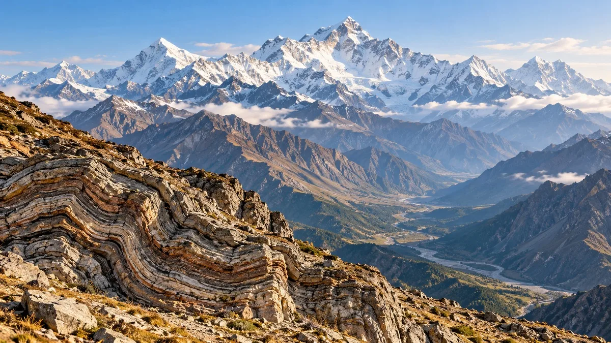
When continental masses converge, their buoyant crust resists being carried down like typical oceanic lithosphere. Shortening, folding and thickening help build high mountains. The Himalayas illustrate the collision of India with Eurasia. This is a convergent setting, but its central explanation is continental collision rather than a typical oceanic subduction volcanic arc.
This distinction corrects a common overgeneralisation: not every convergent boundary has the same landforms or volcanic behaviour. The movement tells us that the plates approach; the material helps explain what follows. In a short answer, state both. Merely writing “collision creates volcanoes” misses the difference between two important settings.
Transform boundaries: movement without a spreading centre
At transform boundaries, plates slide laterally past one another. The boundary is not, by that motion alone, a place where crust is systematically created or consumed. The San Andreas fault system is a standard example. Shallow earthquakes are characteristic, while volcanism is not the defining consequence of the transform movement.
“Conservative boundary” refers to this crustal balance, not to an absence of danger. A boundary can conserve crust while producing damaging earthquakes. Similarly, the word “transform” should not be read as meaning that the rocks must change chemical composition. In this context, it identifies a kind of relative plate motion.
Why slow motion can produce sudden earthquakes
Fault surfaces do not necessarily slide smoothly at the same rate as the broader plate movement. Sections can remain locked while surrounding rock deforms and stores elastic strain energy. Sudden slip releases energy as seismic waves. This explains how gradual tectonic motion can be associated with a brief, intense episode of ground shaking.
Most earthquakes occur near plate boundaries, but “most” does not mean “all.” Earthquakes can also occur within plates, including on older zones of weakness. A location's distance from the nearest mapped boundary is therefore not sufficient grounds to declare it earthquake-free. A broad global pattern must not be turned into an absolute rule about every place.
The article explains earthquake mechanisms, not the date of a future event. Recognising a tectonic setting is different from predicting the exact time, location and magnitude of an earthquake. For exam answers, distinguish an explanation of where activity tends to occur from a claim about when a specific rupture will happen.
How to reason through a boundary question
Use three questions in order. First, what is the relative motion? Second, what kind of lithosphere is involved? Third, do the proposed features fit that combination? For example, an oceanic spreading ridge fits separation, whereas an ocean trench fits subduction. A high continental collision belt needs a different explanation from an island arc.
Next, check the qualifiers. “Always,” “only” and “all” often make a statement broader than the evidence permits. A statement that all earthquakes occur at boundaries is not equivalent to one saying most occur there. Likewise, a statement that every convergent boundary must produce a volcanic arc ignores continental collision.
Finally, keep the scale consistent. A plate is a large lithospheric unit, a fault is a fracture along which movement occurs, and a mountain range is a surface feature. They are connected concepts, not interchangeable names. An answer should show the relationship rather than substitute one term for another.
Relevance for India and the examination
India's Himalayan setting makes continental collision a useful anchor for GS I physical geography. It can be linked conceptually with earthquake hazards in GS III, while keeping the explanation of the natural process distinct from a discussion of exposure and preparedness. State PCS answers can use a relevant regional example without assuming that all Indian regions have identical tectonic conditions.
No specific previous-year question or recent earthquake is attributed here without checking its original record. The focus is the enduring framework: identify movement, explain the process and connect it to the resulting feature. A labelled sketch in an examination answer can support that reasoning, provided the arrows and features agree with the explanation.
Quick revision
- Plates are lithosphere, including crust and rigid uppermost mantle.
- Divergence separates plates; convergence brings them together; transform movement is lateral.
- Oceanic ridges and trenches represent different tectonic settings.
- Continental collision must be distinguished from a subduction volcanic arc.
- Slow plate movement can build strain that is released suddenly.
- Most earthquakes occur at boundaries, but intraplate earthquakes also occur.
Practice question
Which observation most directly indicates a divergent boundary: formation of new oceanic crust at a spreading ridge, consumption of oceanic lithosphere at a trench, lateral sliding without systematic crust creation, or continental shortening?
Answer: Formation of new oceanic crust at a spreading ridge. The other descriptions correspond respectively to subduction, transform motion and continental convergence.
Practise next: Attempt the related MCQs and revise notes on plate boundaries and landforms in the IASLadder app.
Practicing UPSC Prelims PYQs?
Practice 45+ years of topic-wise previous year questions (1979–2026) with in-depth explanations on our mobile app.
Never miss a daily update
Join our official Telegram channel or WhatsApp group for daily current affairs and test alerts.
Frequently Asked Questions
Test yourself · 10 practice questions
Practice MCQs on Plate Tectonics: Boundaries, Earthquakes and Mountains
Check how well you understood this article with 10 UPSC-style multiple-choice questions — instant answers with detailed explanations.
View all questions with answersTags
Related Articles
Colonial Land Revenue: Permanent, Ryotwari and Mahalwari
What was permanent in the Permanent Settlement, and what did direct settlement with a ryot actually change? Compare colonial revenue system…

Constitutional Writs: Articles 32 and 226 Explained
Constitutional remedies depend on the right involved and the legal defect requiring correction. Understand how Articles 32 and 226 differ, …
Ocean Currents, Upwelling and Climate: A Conceptual Guide
Why can a sunny coast have cold water and rich fisheries? Understand how winds, rotation and density shape ocean circulation. This guide ex…
Keep reading
More in Optional & Subjects
- Optional & Subjects Fiscal, Revenue and Primary Deficits: Reading the Budget
- Optional & Subjects Ecosystem Energy Flow: Food Chains and Ecological Pyramids
- Optional & Subjects Inflation in India: CPI, WPI and GDP Deflator
- Optional & Subjects Western Disturbances: Why North India Gets Winter Rain
- Optional & Subjects Soils of India: Types, Distribution and Key Features
- Optional & Subjects Indian Monsoon Explained: Mechanism, Branches and Breaks